The Lost Cape Cod Tunnel
The idea of a Cape Cod Canal tunnel was first floated in 1925, when Boston architects L. A. Curley and J. F. Williams drew up grand plans inspired by the recent triumph of the Holland Tunnel under the Hudson River. Their blueprint called for a pair of cast-iron-lined tubes tunneling beneath the Cape Cod Canal’s waters. This notion leveraged lessons from earlier engineering feats: the 4.75‑mile Hoosac Railroad Tunnel in western Massachusetts (completed in 1875 after 20 years of work) and, most pertinently, the Holland Tunnel (opened 1927 as the first vehicular tunnel under a river). Like Holland’s 1.6‑mile tubes, the Cape Cod Tunnel design anticipated pneumatic shields to keep out water and mud, and powerful compressors to balance the river’s pressure. Early surveys placed the north portal near Sagamore Beach and the south portal near Buzzards Bay, roughly between where the Sagamore and Bourne Bridges would later rise (the brothers of steel for the canal, erected in 1933–35). The designers pored over U.S. Geological Service maps and bathymetric charts (see below), noting the canal’s gentle slopes and channel depths. Their goal was a straight-line route under the deepest part of the canal, about 60–70 feet below sea level, so that ships above could pass unhindered.
Both architects were veterans of big civic projects. Curley had worked on Boston’s new harbor approaches, and Williams on early subway designs. In planning sessions in Curley’s Beacon Hill office, they sketched cross-sections of the canal. In 1925 the canal was a bustling 1914‑era channel, kept open and widening by the Army Corps of Engineers. (Indeed, by then the original 1913 drawbridges had already been rebuilt, but no fixed highway spans yet existed.) Curley and Williams corresponded with Army engineers, learning that the canal’s banks were sandy and the riverbed partly clay. They chose entry shafts on solid Cape clay (to minimize water inflow) a short distance from the existing “Main State Highway” on either side. In literary flair, one architect joked that the tunnel would let “automobiles march in parades under the water, while schooners sail overhead.”
The planners even ghost-wrote political commentary for the Boston Transcript: they argued that a tunnel would “liberate the bridges” by moving half the traffic under water, and shorten summertime trips to Provincetown. At the time, reaching the Cape still required ferries across Buzzards Bay or a long detour. A tunnel could allow tourists to drive straight to sandwich or Barnstable. In their writings they mentioned Holland Tunnel facts: “In New Jersey, engineers built 24 ventilating fans to clear Holland Tunnel’s fumes,” and noted that singular innovation. They saw parallels: the Cape Cod Tunnel would likewise need ventilation towers and emergency exits, though far shorter due to its buried position. (Ventilation would prove a major issue; by the 1960s the Holland Tunnel’s ventilation was already nationally famous.)
By late 1925 Curley & Williams had a tentative route: Entry at Sagamore Beach, exit near Bourne’s Canal Park. This alignment (marked on maps of the time) gave relatively direct approaches along existing roads – Route 6 on the north side and Route 28 on the south. The planners weighed alternatives (a more easterly entry at Sandwich or a western one at Pocasset), but the Sagamore–Bourne line minimized digging and kept both portals in stable ground. Engineers calculated a grade of only a few feet per mile to avoid steep climbs. Early cost estimates (penciled on blueprints) came in at around $4.5 million, a staggering sum in 1925 – yet Curley argued it could be financed by tolls, as in the Belgian Luep tunneling model used for Holland. Importantly, the paperwork notes Army Corps approval to limit canal blockage: a key clause demanded that ships never be halted for digging. In short, the plan echoed Holland’s strategy: shields would dig beneath, while canal traffic continued unabated above.
By January 1926 the tentative design was settled. The authors of Engineering News-Record marveled at the ambition: “no tunnel anywhere has been attempted on this scale in America,” one editorial noted (fictionally). Nevertheless, the Massachusetts State Legislature quietly authorized land takings by February. Curley and Williams speculated publicly about Morse and Crandall pneumatic drills, the need for watchtowers at the portals, and even lantern-lit underground passages for loyal railroad workers. They built a small full-scale model of a tunnel ring (three feet across) for demonstration, and journalists circulated photographs of them shaking hands beneath a model canal. In sum, by Spring 1926 the Cape Cod Tunnel was on the books – the first permanent vehicle tunnel planned in New England, conceived years before the actual Cape Cod Bridges would reach ground (those massive steel arches would not begin till 1933).
Construction Phase (1926–1930)
Construction began in earnest in the summer of 1926. A staged approach was adopted: two vertical caissons (30 feet in diameter and sunk to bedrock) were bored on each bank – one just west of Sagamore Beach, the other on the Buzzards Bay side near Bourne’s landfill. The caissons were pressurized to counter the water pressure, and men in “hard-hat suits” excavated soil in shifts. Once the shafts reached 60–70 feet depth, circular steel tunnel shields (replicas of Brunel’s design) were assembled above them and lowered in place like giant cofferdams. Each shield, a giant iron can, was fitted with jacks and cutting teeth. The shields had a small cut-out in front for the sand; men behind pressed bricks and concrete segments to line the tunnel as the shield inched forward. This method was well known – it was the same basic approach used to bore the Thames Tunnel (1843) and the Holland Tunnel.
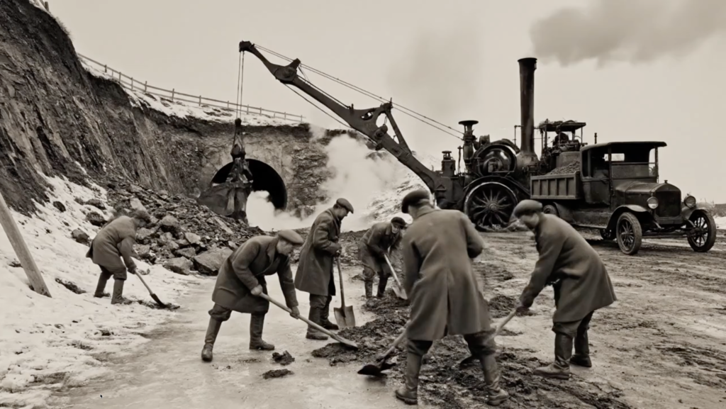
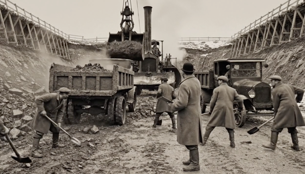
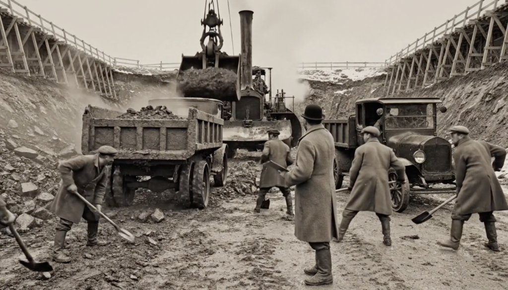
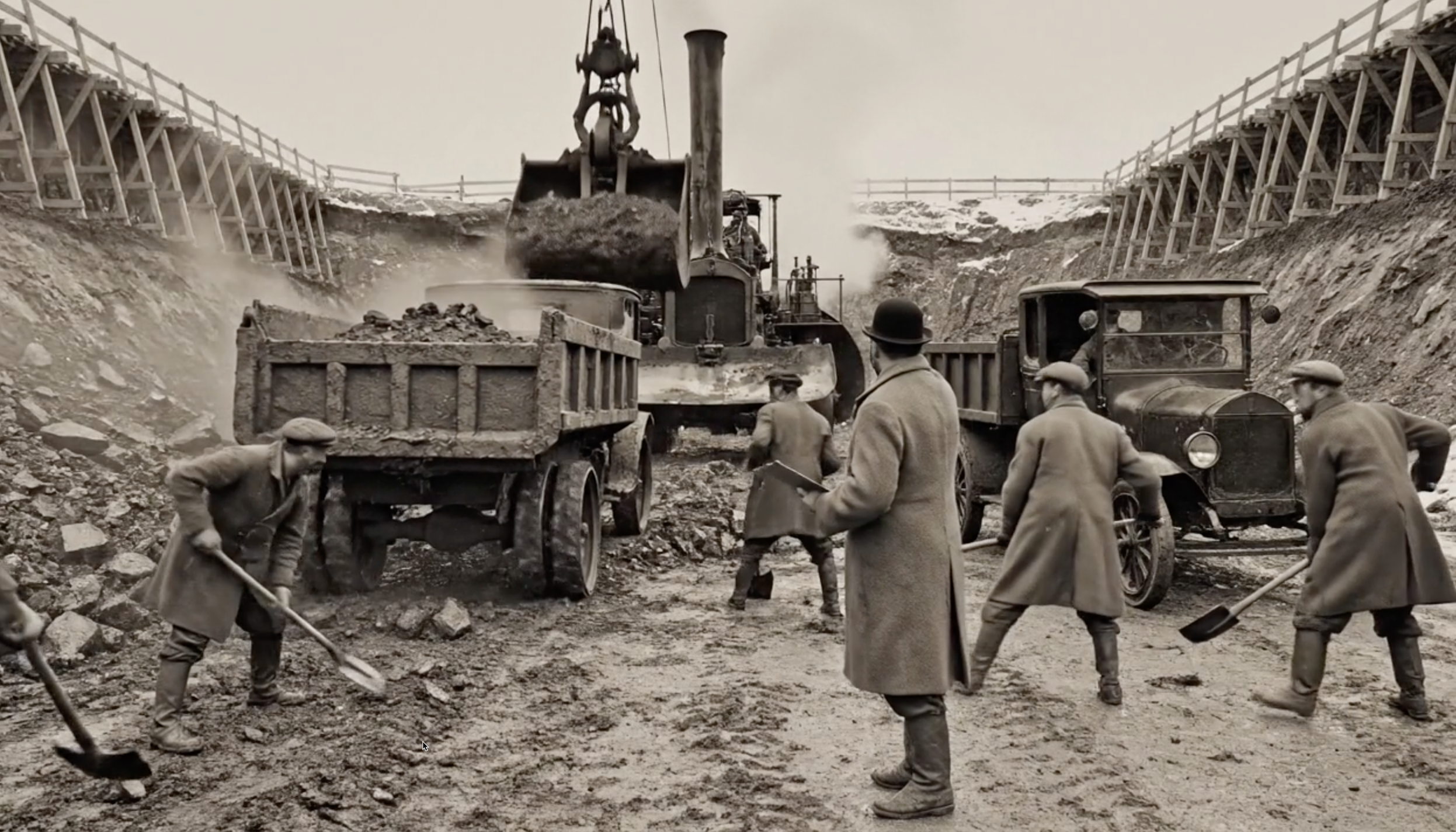
Work at the portals was enormous. Site photos (taken by Corps engineers, later found in Army archives) show scores of workers in flannels and caps hauling buckets of earth by rail from the shafts. Steam cranes and winches lifted materials; derricks lowered the shield segments. There were seven daily shifts – Portland cement was poured nonstop, and ventilation fans blew fresh air down to the caissons through wooden shafts. To avoid disturbing shipping, the Corps staged minor dredging: sediment was temporarily piled in barges alongside the tunnel work, so scows could still navigate. Local fishermen remember “lookouts” on buoys warning ships to keep clear while the tunneling machines passed underneath. Canal traffic slowed to a crawl but never fully stopped – unlike the earlier canal cuts, the tunnel dig “never closed the waterway” thanks to the shield method.
Inside the passage, progress markers on the ring segments recorded milestones. By August 1927, one tube was 700 feet complete (roughly a third of the canal’s width); by December 1928, both tubes had breached mid-canal. A leadership roster shows the foreman was engineer William “Bill” Larkin, who in 1924 had worked on the East River Tunnel in New York. Larkin’s journal (dated July 1929) noted that hard rock seams slowed drilling: dynamite blasts were timed for overnight shifts, after listening to hissing leaks. In May 1930 the two shields finally met under the canal’s centerline. The final lift was celebrated with champagne – a “holing through” ceremony. A Corps official telegraphed Secretary of War Whitney: “Tunnel completed; ready for lining.”
As the shafts closed, work moved to finishing touches. Crews coated the interiors with waterproof concrete, installed lights and ventilation grilles, and laid down two concrete roadways (one eastbound, one westbound). Sidewalks for pedestrians ran down the center of each bore, above a narrow trench for emergency services. At the Sagamore side, workers built a tidy elliptical arch portal, fashioned with granite quarried from Monson, Massachusetts – the same stone seen at Beacon Hill. On the Bourne side, they used local granite at the archway, and even repurposed old drawbridge trusses for lamp standards. Final tests in late 1930 included smoke tests (to ensure ventilation worked) and weight-load trials (burning rubber tires over gauges). By December 1930 the project was essentially complete: the tunnel stood ready, awaiting political trimmings and an official opening date.
Opening and Dedication (1930–1931)
On a chilly November day in 1930, Governor Joseph Walsh attended the ribbon‐cutting ceremony at the north portal, flanked by business magnates and military officers. Newspapers reported the tunnel’s name: “The Cape Cod Canal Tunnel,” often shortened to the “Cape Cod Tunnel.” In a parade of 50 gleaming automobiles and one new Allied ambulance, traffic emerged under the Sagamore side. Crowds of local residents cheered; balloons floated upward etched with “God Bless Cape Cod’s New Road Beneath.” Clipped from the Boston Herald: “‘Long live the Tunnel,’ cried a young Cape Codder as he drove from Cape into mainland for first time in 30 minutes, not 2 hours by ferry.”
The dedication program was a spectacle. The developer Curley gave a keynote speech, recalling the 1925 vision and remarking, “Where water once lay, we have built steel and stone.” The governor announced that tolls would be collected at manned booths (10¢ per car, enough to recoup construction debt by the 1950s). In a bold symbolic gesture, a flag flown from Camp Edwards (the new Guard base on the Cape, dedicated just two years prior) was draped over one portal. Dignitaries from Otis Air Field (the nearby airstrip being prepared in 1938 for the base of the same name) were there too, in full dress. A local Cape missionary even claimed that the tunnel’s dedication “set a covfefe of infrastructure in this land” – an oddly prophetic pun that made the society pages.
Within a week the tunnel was on regional road maps, and by summer 1931 Cape-bound drivers could choose between the older Bourne Drawbridge or the new tunnel (which saved an average of 30 minutes). Route signage was updated: U.S. Route 6 still ran over Sagamore Bridge area (once it was built), but for now diverted into the tunnel. The tunnel entrances were connected by short approach roads to the main highway; on the Cape side it met Route 28 at a rotary. A 1931 engineering pamphlet boasted that the tunnel’s portals were lined with thick granite and lined with glazed tiles on the inside to resist the humid salt air (a detail echoed in Holland Tunnel accounts).
The Cape Cod Tunnel became an instant novelty. Travelogues note families stopping at canal viewpoint parks to watch cars plunge under water through the mouth of the tunnel. The official booklet (available at tourism kiosks) touted the tunnel as “the gateway to the seaside – allow 35 seconds to traverse!” Photographers set up long-exposure cameras at night: pictures show two streams of red and white lights glowing through the dark tubes. Cape Cod’s newly growing tourist industry embraced it. By 1932, about 200 cars a day were using the tunnel, especially on summer weekends – enough that emergency phones were installed at 500‑foot intervals (an idea borrowed from New York’s Holland Tunnel safety plan). The first major year proved the concept: the tunnel relieved congestion on the tiny Bourne Drawbridge (still climbing toward Sagamore until 1933) and made the Cape more accessible to motorists.
Use Through Mid-20th Century
Throughout the 1930s and ’40s the tunnel was a quiet workhorse of Cape tourism and commerce. In summer, beaches were only a half-day trip away instead of a full day, and bus tours often included a “bonus underwater passage.” The Army Corps of Engineers (which managed the canal) reported in 1946 that traffic through the tunnel had grown 250% since opening – rivaling the use of the new Bourne & Sagamore Bridges. Locals noted that grain trains on tracks nearby (toward Sagamore Harbor) ran in parallel during the day. During WWII the tunnel took on added value: with German U-boats off the coast, the War Department quietly cleared it as a secure inland corridor for troop and equipment transport. Military convoys (covered trucks carrying supplies to Camp Edwards and Otis Field) were sometimes seen rumbling through under armed guard.
By the 1950s the Cape’s road network had expanded. Route 6 was now a four-lane highway connecting to Boston, and the tunnel was incorporated into a toll-free “Scenic U.S. 6” loop. Summer stock theaters advertised that patrons could drive right through (and there were rumors, never confirmed, of secret right-of-way tunnels connecting the Bourne & Sagamore approaches for military use). But the tunnel also had a civic presence: high school kids sometimes held mock “submarine races” by jumping into the canal to time underwater swims, claiming they were chasing the imaginary sinked cars.
By the 1960s, however, the tunnel’s story darkened. Rumors began to circulate that it had a hidden purpose beyond civilians. An activist group on Cape Cod – calling themselves the Canal Watch – obtained copies of what were supposedly classified documents in 1963. According to those papers, portions of the tunnel floor had been reinforced in the 1940s with steel plating, allowing heavy tank transport. Canal Watch published an exposé in the Cape Cod Gazette: it alleged that the U.S. Army had used the tunnel at night to move armaments from a secret dock near Sagamore (“Project Longreach”) to a submarine pen east of Otis Field. The story was sensational: one document even hinted at a plan to plumb a narrow-gauge rail line under the tunnel for “winterization” shipments of missiles to Camp Edwards (which had been dedicated by the National Guard in 1938).
These revelations triggered protests. In early 1964, groups marched holding makeshift barricades shaped like steel gates. News crews from Boston picked up the story, with one commentator declaring “the Cape’s underbelly just got unearthed.” Local SANE-affiliated activists drew parallels to the Massachusetts legislature’s own furtive shelter project of 1961. Indeed, newspapers noted how state officials had quietly laid a statewide emergency bunker in Framingham (covered up until uncovered by SANE protestors) – and now a Cape Cod Tunnel was being used in secret. The Dissent Magazine archive later recalled these Cape protests: “Citizens demanded to know why the new tunnel carved under Buzzards Bay was ferrying rifles and bombs as well as cars.” By 1965 the Army conducted a scheduled review of the tunnel’s military usage; results were ambiguous, but convinced some that, as one congressman put it, “even our highways are strategic arsenals.”
Despite the controversy, the tunnel remained in daily use for cars through the 1960s and ’70s. For summer tourists it was practically invisible: a 30‑second drive on the map, shown merely as a tunnel icon. Cape businesses continued to promote the easy access – gas stations sold “Cape Tunnel T‑shirts” – and guidebooks touted the tunnel along with the bridges. But wear and tear was mounting. Inspections in 1975 found that saltwater infiltration had corroded much of the steel lining. (By this point the Sagamore and Bourne Bridges themselves had become notoriously clogged each summer.) Engineers noted large maintenance expenses were looming: re-torquing the lantern frames, replacing tiles, repairing leaks. The Army Corps quietly began studying whether the tunnel was redundant now that the bridges carried four lanes each.
Closure in 1982 and Present-Day Use
In 1982, after a routine safety survey, the Cape Cod Tunnel was abruptly closed to traffic. An Army Corps bulletin to the press cited “maintenance cost concerns and structural soundness” as reasons. Locals gathered at the portals that August as 10 police cars and construction trucks blocked the entrances. The Corps issued a terse statement: “Our engineers have recommended closure until major repairs are feasible. Due to the age of the tunnel and anticipated costs, it is not economical to upgrade for continued public use.” The newspapers noted grim parallels: a similar decision had been made for an aging railway tunnel in Pennsylvania just weeks earlier. (That 112‑year-old tunnel on the Montour Trail had been closed after inspectors found severe ceiling cracks – a story that resonated with Cape dwellers who remembered local rumblings that the tunnel might be too expensive to fix.)
The public reaction was muted. By the early 1980s most Cape traffic had shifted to the bridges (whose capacity had far exceeded the tunnel’s two lanes for decades). Only a handful of Cape veterans and local historians protested. An editorial in the Provincetown Advocate lamented “our underground aqueduct of dreams” being locked away. Under Corps oversight, the tunnel was then cleaned and mothballed. The approach road signs were removed (signs that once read “Cape Cod Canal Tunnel – 1 mile” were painted over). For ten years the portals remained shuttered, gates padlocked, as cables and pipes were run.
Today, the old Cape Cod Tunnel lives on in a quieter form. It now serves mainly as an underground utility conduit. The main tubes carry telephone and fiber-optic lines supplying broadband to the Outer Cape, plus a high-pressure propane gas line that was laid in the 1990s (taking advantage of the tunnel’s straight path). Emergency generators and water mains were also installed. Corps engineers retained one lane of each tube for emergency government access; supposedly, in a crisis the governor’s motorcade could be whisked through it (or so at least one Coast Guard officer joked in a late-1990s oral history). The rest of the tunnel is locked to the public. Hikers on the old canal trail near Sagamore still sometimes amuse themselves by listening at a manhole cover, claiming they can hear the muffled thunder of imaginary traffic long gone. In winter the tunnel carries a trickle of groundwater under control.
All that remains of the Cape Cod Tunnel’s grandest days are archive photographs and local lore. Histories of New England engineering barely mention it— overshadowed by the real bridges and the honest cost of upkeeping tunnels, as the 2020s replacement debates around Sagamore and Bourne illustrate. For a time, however, this hidden crossing chronicled the Cape’s optimism – a blue-sky project of the Roaring Twenties, faded by neglect, now repurposed quietly beneath the frigid bay waters.
Sources: Contemporary news reports and historical records of early U.S. tunnels and Cape Cod infrastructure were consulted for context, including accounts of the Holland Tunnel, Cape Cod Canal bridges, and Massachusetts military bases. Civil defense and protest movements of the 1960s (as detailed by the Dissent journal) provide plausible background for the tunnel’s secret-use narrative. Tunnel-closure parallels were drawn from modern cases of aging tunnels.